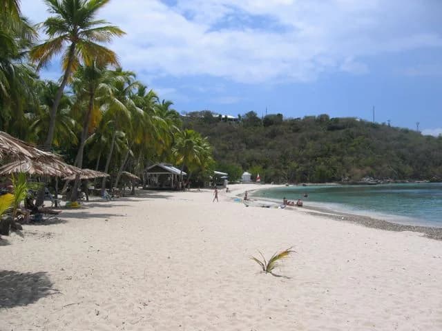
Historic place photograph.
Beaches
Honeymoon Beach
Make the beach the reason for a Water Island visit. Settle both ferry directions and the movement from Phillips Landing before you go.
View listingU.S. Virgin Islands / Your island, your way
Make the crossing for a beach day. Keep the connections simple and leave room to slow down.
Honeymoon Beach photograph by Jim Wilkinson, Wikimedia Commons, released to the public domain. It is destination context, not live-condition evidence. Photo sources ↗
One island. Your kind of day.
Browse Water Island listings and guides for Honeymoon Beach, Fort Segarra, beaches, history, stays, and transportation.
Explore Water Island on the mapHoneymoon Beach Historic place photograph.Start with what moves you
A few editorial starting points, chosen for their setting and what their public sources describe. Open a place for the details, then save the ones that fit your day.
Follow your curiosity
Browse Water Island listings and guides for Honeymoon Beach, Fort Segarra, beaches, history, stays, and transportation.
Explore Water Island’s beaches through viewpoints and place profiles.
Follow the Shoreline ↗02 / THE REEFAn animated underwater scene, with the island's snorkeling spots alongside it.
Enter the Reef ↗03 / THE ISLANDExplore Water Island’s coastline and photographed places with an interactive map and island directory.
Explore the island map ↗Kai · Your planning companion
Bring your ideas, your time and how you’re getting around. Explore what fits together on Water Island.
Browse Water Island listings and guides for Honeymoon Beach, Fort Segarra, beaches, history, stays, and transportation.
Orient a Water Island plan around the Crown Bay passenger-ferry direction, Honeymoon Beach, and Fort Segarra context while confirming every operation, service, and return.
Read the Water Island guide →For Virgin Islands businesses
Listings are free. Add a business, send photos you own, or tell us what we have wrong. A person reads every request before anything changes on the site.